An official website of the United States government.
Here's how you know.
Official websites use .gov
A .gov website belongs to an official government organization in the United States.
Secure .gov websites use HTTPS
A lock () or https:// means you've safely connected to the .gov website. Share sensitive information only on official, secure websites.
Contact Us
For EGP user support, or to make additional role requests, contact the IIA Helpdesk at:
- Phone: 866-224-7677
- Web: https://iiahelpdesk.nwcg.gov/ and use the "Contact Us" or "Chat with an Agent" links.
- User Feedback Form
Helpful Resources
Training Materials by Application
---
The Situation Analyst (SA) application is an integrated tactical and operational decision support tool used for wildland fires. SA combines a traditional "common operational picture" with collaborative mapping, geospatial and imagery analysis, and analytical reporting.
Open SituationAnalyst (SA)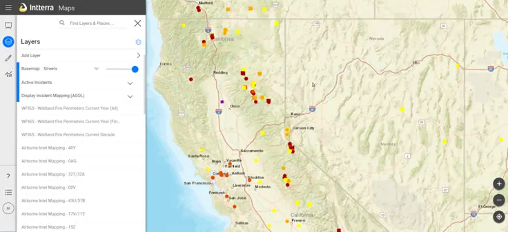 ---
Click the open frame icon within the video to expand to full screen
---
Click the open frame icon within the video to expand to full screen
Introduction to Navigating SituationAnalyst
How to Export and Access a File GDB
How to Export and Access a Geospatial PDF Map
How to use the Airborne Intel Tool
How to use the Briefing Mode
---
Enterprise Geospatial Portal (EGP) Lightning Viewer is a web application developed for EGP to provide lightning strike counts, weather patterns, mapping, and geospatial data with animation capabilities for lightning strikes up to seven days. Lightning strikes are depicted using blue dots for negative strikes and red dots for positive strikes. Data is maintained by the Bureau of Land Management (BLM).
Open Lightning Viewer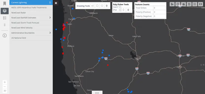
### Training Materials
- Frequently Asked Questions
- Lightning Viewer User Guide
---
The NWCG Airtanker Base Directory offers a single source of information on airtanker bases across all Geographic Areas. The Directory is intended to aid wildland fire managers, pilots, and contractors in the use of airtanker base facilities. The Directory is not intended to supersede any regulations, authority, local procedures, Federal Aviation Administration regulations, laws of any entity, common sense, or the authority of the Pilot-in-Command.
Open Airtanker Base Directory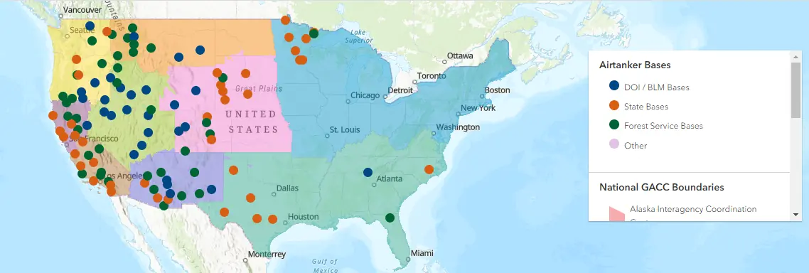
### Training Materials
- Frequently Asked Questions
---
WPSAPS, is a web-based application designed to make wildfire prevention program risk assessment, planning, and accomplishment reporting more efficient and effective. It provides users with a research-informed set of prevention actions based on a geospatial assessment of the risks, hazards, and values to be protected in their management unit. For user training information, contact your agency wildfire prevention lead.
The outputs from WPSAPS provide a foundation for a well-organized, intentional, prevention program. WPSAPS was developed specifically for the wildfire prevention community by an interagency workgroup composed of wildfire prevention personnel. This video provides an overview of the use and capabilities of the software.
Open WPSAPS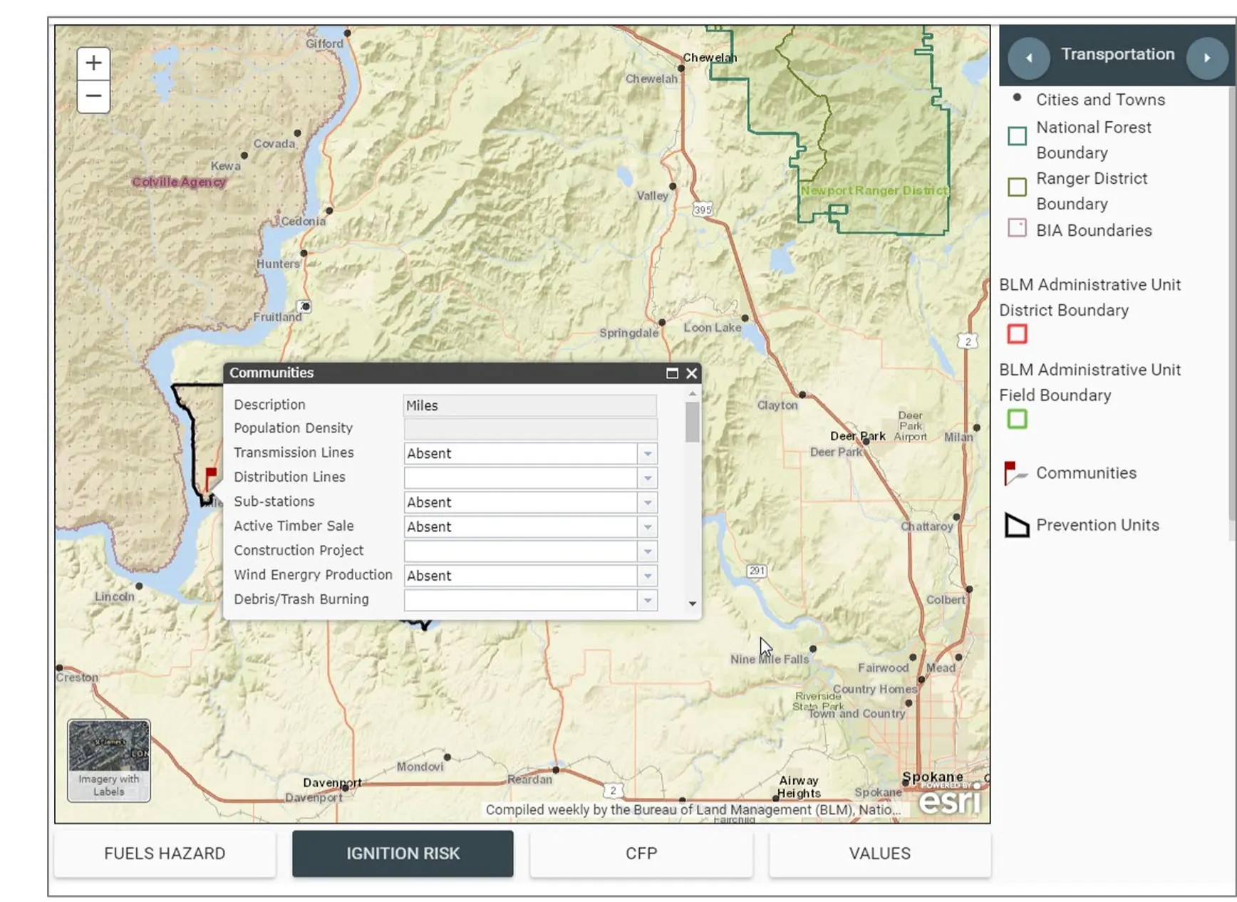 ---
Click the open frame icon within the video to expand to full screen
### Videos
### How - To Videos
### Previous Course Instructional Recording
---
Click the open frame icon within the video to expand to full screen
### Videos
### How - To Videos
### Previous Course Instructional Recording
### Training Materials
- WPSAPS User Guide
### Videos
- Introduction to WPSAPS
### How-To Videos
- How to use the Union Tool
- How to Report Community Accomplishments
### Previous Course Instructional Recording
- Units 0 & 1 - Orientation & Introduction
- Unit 2(A) - The Risk Assessment – Setup
- Unit 2(B) - The Risk Assessment – Data Entr
- Unit 3 - Planning Maps
- Unit 4 - Prevention Plan Development: Benchmark Scenario
- Unit 4 - Prevention Plan Development: Custom Scenario
- Unit 5 - Yearly Action Plan – Planning
- Student Exercise Overview
- Unit 4A Worker Hours/Budget Pathway
- WPSAPS Cloning and Bringing Data Forward